Taum Sauk Mountain State Park
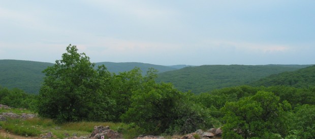
Climb to the top of Taum Sauk Mountain State Park and be on top of Missouri – literally. The park’s 7,500 acres include the highest point in the state. Located in the St. Francois Mountains, the park’s glades provide a beautiful, solitary experience for hikers. A series of trails, including a portion of the Ozark Trail, wind through the park’s picturesque setting and provide awesome views of the surrounding countryside; including the state’s tallest waterfall & its deepest valley which can all be seen on an afternoon hike. 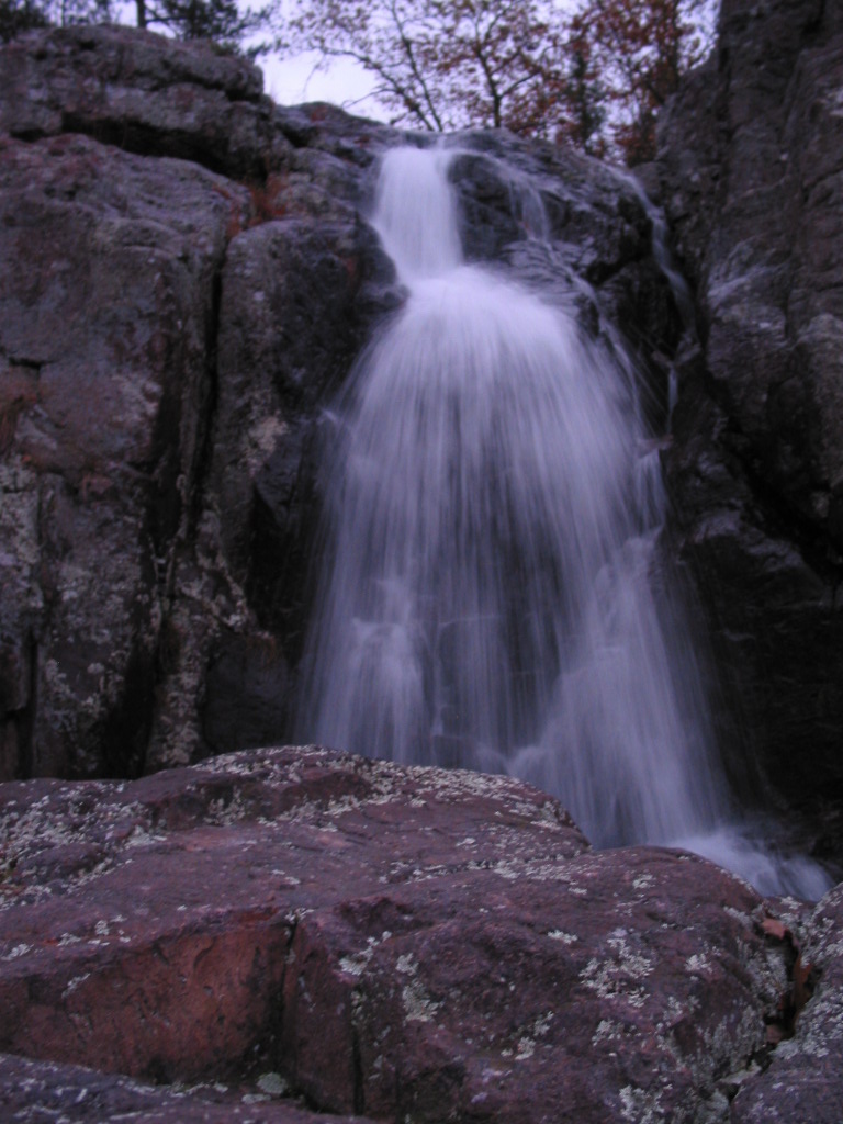 (8 miles south on Hwy 21, then take Hwy CC)
The park has a rustic campground, a paved trail to the highpoint, picnic facilities, and a lookout tower from which a good view can be had; the dense forest on the mountain obscures the view from most other vantage points.
Mina Sauk Falls, the highest waterfall in Missouri, is on Taum Sauk and can be visited by hiking a rugged trail that makes a three-mile (5 km) loop from the highpoint parking area. The falls have cascading waters only during times of wet weather; at other times they are reduced to a trickle or less.
The Taum Sauk Section of the Ozark Trail is 35 miles long and runs through the heart of the ancient St. Francois Mountains. One of the most popular and scenic portions of the Taum Sauk Section is the 14.5 miles between Taum Sauk Mountain State Park and Johnson’s Shut-Ins State Park. This rugged portion of trail through two state parks winds across mountains of oak-hickory woodland dotted with shortleaf pine trees, bluffs and rocky glades.
Head south on State Route 21 from Arcadia, Missouri for about 4 and a half miles. Turn right onto Highway CC which is signed for Taum Sauk Mountain State Park. Along Highway CC you will see an Adopt-A-Highway sign listing the highpointers club and it’s founder Jack Longacre who apparently lived in this area. After a few miles the pavement will end near a fork in the road. To the left is a lookout tower with wonderful views, to the right is Taum Sauk Mountain State Park. Once in the park there will be a viewing platform on the right side of the road that includes a panoramic photo labeling the peaks and valleys before you. At the end of the road is parking for many vehicles.