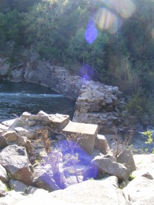
Silver Mines Recreation Area
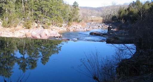
This is an abandoned mining town on the St. Francois River with shut-ins, 200 foot bluffs and scenic hiking trails. There is a 2-mile Silver Mines Trail which follows both sides of the river, leading to various picnic areas. Also a 1.2-mile trail spurs to Millstream Gardens Conservation area, where visitors can view spectacular rock formations along the river.
(12 miles east on Hwy 72)
Silver Mines offers a variety of recreational opportunities and is abundant with historic and geological wonders. This beautiful area is located along the St. Francis River, the only river in Missouri classified as “white water,” and is used for kayaking during the spring high waters. Silver Mines is located at a historic mining operation and is known for its Precambrian granite and felsite rocks. Silver Mines Recreation Area is named for the abandoned “Einstein Mine”, which was mined for Silver, Tungsten and Lead. The Einstein Silver Mining Company began mining in 1877, and mining ceased completely in 1946.
The 2-mile long Silver Mines Trail follows both sides of the St. Francois River. The west section of the trail leads to the Riverside Picnic Area. The east section (1 mile) leads to the Turkey Creek Picnic Area. From there, the trail leads 1.2 miles to the Millstream Gardens Conservation Area, home to the Missouri Whitewater Championship Races every spring.
Eight picnic sites are available, each offering a table and pedestal grill. A group pavilion Is also available, with 6 picnic tables, a large pedestal grill, and parking for up to 20 vehicles.
Although mostly popular with kayakers in the spring, the St. Francois River is also a popular swimming hole during the summer months. There is no acutal designated nor managed swimming area, so please enter the river at your own risk. The current can be swift at times, especially during high water. Large rocks and drop-offs are abundant in this river.
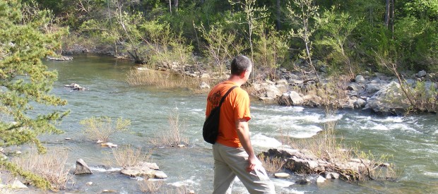
Millstream Gardens Conservation Area
The only whitewater kayak area in Missouri is home to the first race of the season in March of each year. The large volume of water of the St. Francois River flowing through Tiemann Shut-Ins is another of the Valley’s beautiful sites. The park has a paved trail down to the shut-in area. (8 miles east on Hwy 72)
Millstream Gardens Conservation Area is a 697-acre tract of land in Madison County, about halfway between Fredericktown and Arcadia, off of State Route 72. The Tiemann Shut-ins are within the area’s boundaries. The St. Francis River forms one of the area’s western boundaries, then meanders eastward for 1.2 miles through the area’s mid-southern section, before rushing through the shut-ins and passing into the Silver Mines area. The area’s woodlands are composed primarily of oak, hickory, and pine in the uplands, and ash, elm, and maple along the river border and its drainages. The St. Francis River at Millstream Gardens, and its wooded corridor, is a part of Missouri’s Natural Area System. This large stream contains an adjoining slough and large igneous shut-ins. A wide variety of animals live here. Wildlife species such as whitetail deer, turkey, and squirrel inhabit the uplands.
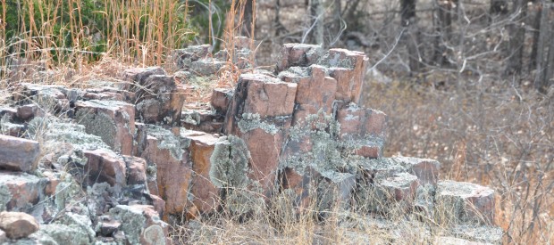
Hughes Mountain-Devils Honeycomb
Within the Hughes Mountain Natural Area is a glade with an outcrop of columnar jointed rhyolite designated the Devil’s Honeycomb. Devil’s Honeycomb is listed in the book, Geographic Wonders and Curiosities of Missouri.
(5 mi. east on Hwy M from Hwy 21)
The area around Hughes Mountain was first settled ca 1810 by John Hughes, his wife (Susannah) and their children, resulting in the mountain being named Hughes Mountain. The mountain itself remained public land until 1861 when purchased by John Hughes’s son, Mahlon Hughes and afterwards remained in the Hughes family until it was purchased by the Missouri Conservation Commission in 1982. At that time it was designated a State Natural Area.
The Hughes Mountain State Natural Area can be accessed by the public via a 1.4 mile (2.253 kilometers) linear/loop trail with the trail head in a small parking area on Highway M 3 miles (4.8 km) southeast of Irondale. Within the Hughes Mountain Natural Area is a glade with an outcrop of columnar jointed rhyolite designated the Devil’s Honeycomb. Devil’s Honeycomb is listed in the book, Geographic Wonders and Curiosities of Missouri. The natural area is divided between forest land (about 2/3 the total area) containing three types of forests, and glades(about 1/3 the total area).

Bonne Terre Mines
Bonne Terre Mine is listed as one of Americas top ten greatest adventures by National Geographic. Boat & walking tours available; Along this tour, you will see Huge Pillar Rooms, Grand Canyon, Billion Gallon Lake, Trout Pond, Underground Flower Gardens, Beautiful Calcite Falls, and ancient abandoned mining tools, submerged ore carts, wrapped pillars, and ancient abandoned overhead wooden cat walks suspended 50-100 feet above the lake. (On Hwy 67 in Bonne Terre)
One of the world’s largest man-made caverns, founded in 1860 as one of history’s earliest deep-earth lead mines. This was the world’s largest producer of lead ore until it was closed in 1962.
The mine has five levels. Not suitable for service animals. The two upper levels are lighted and used for one-hour, guided walking tours along the old mule trails, showing were miners dug with pick and shovel in the 1860s. (Tour includes a 65-step staircase, in and out.) The mine is a constant 65-degrees, year-round; never affected by the weather.
The lower three levels form a one billion gallon, seventeen-mile long lake, illuminated by more than 500,000 watts of stadium lighting above the water’s surface. Boat tours are available on the crystal clear water, with spectacular views of the abandoned shafts and equipment below.
The mine is home to the largest fresh water scuba diving venue in the world. (Diving reservations are required.) The clear, 58-degree water, illuminated from above, affords divers visibility more than 100 feet down. Diving is conducted in groups of nine, always accompanied by two guides.
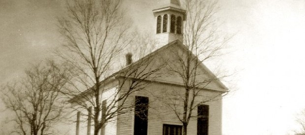
Immanuel Lutheran Church, 1861
On the National Register of Historic Places, this building still contains the original hand hewn wooden pews, the original pipe organ, and the sonorous bell, still in use today. (in Pilot Knob)
As the Civil War broke out, a group of German immigrants began building their new church. Little did they know that in 1864, three years after the building was completed, wounded soldiers would lay dying in the place of worship. Doctor Seymour Carpenter, Major, US Army, established several makeshift hospitals in the town of Pilot Knob in preparation of the day of battle. On September 27, 1864, despite the good doctor’s efforts, there were more wounded soldiers than his staff could handle or his hospitals house. Since that day, the church has barely changed and remains a beautiful example of a small town 1860s church right down to having the original pastoral robes.
When the Civil War began, many of Immanuel’s men enlisted in the Pilot Knob Home Guard to protect the area from rebels. From time to time, the church was used by them and later the Union Army as a meeting place. The railroad terminated just a few blocks east of the church, as did the telegraph lines. Early in the war, the church made an ideal outpost for the soldiers who were stationed in Arcadia at Fort Curtis. Many of the troops from Iowa, Illinois, Wisconsin and Missouri were German immigrants or of German stock and mixed freely with members of Immanuel. Several frequently joined the church members in their worship.
After Fort Davidson was built in 1863, Immanuel still served the Union cause, because the fort was only a fortified position and lacked any buildings necessary for the army’s administrative functions. To this day, the congregation possesses a Union telegram book, many of whose telegrams do not appear in the official Records of the Civil War.
The entire Arcadia Valley shook with cannon and gun fire on Sept. 26 and 27, 1864, as Gen. Sterling Price’s Confederate army hammered at Ironton and Fort Davidson. By the time the fighting ceased on the 27th, more than 1100 soldiers lay dead or wounded. After rebel fire began peppering St. Mary’s and the schoolhouse, Dr. Carpenter commandeered Immanuel Lutheran Church as the main hospital and several local houses to tend to the wounded.
Marble Creek Recreation Area
The attractively colored dolomite, from which the area is named, can be seen as well as remains of a grist mill and dam. Swim in the old mill pool where the creek was once harnessed to power the mill. Enjoy picnicking, hiking, biking or fishing!
(15 miles on Hwy E)
This area with its beautiful creek, camp and picnic grounds is located between Fredericktown and Arcadia, MO. Marble Creek, rushing 20 miles through the rugged St. Francis Mountains, is named for deposits of attractively colored dolomites which were mined and used in the building trade as “Taum Sauk Marble”. Within the recreation area, you can see the concrete remains of a grist mill dam and building foundation. This dam was the third to be built here and was operated until 1935. This quiet campground and recreation area is the main trailhead for the Marble Creek Section of the Ozark Trail. This 8-mile segment goes to Crane Lake and is open for hiking, equestrian and mountain bike use. Horses are allowed at trail head, but not within campground or picnic area.

Royal Gorge
A photographer’s paradise with its natural rock bluffs. This gorge is referred to as a shut-ins. Shut-ins occur where a broader stream is “shut in” to a narrow canyon-like valley. In Missouri, shut-ins typically are found where streams flow through softer sedimentary bedrock such as dolomite and then encounter more resistant rock like rhyolite. Rhyolite is considered an igneous rock, one formed from magma, molten rock.
Above the creek valley the vegetation is stunted growing on the open rhyolite rocks with a western exposure. These igneous glades provide harsh growing conditions. Short-statured and gnarled blackjack oaks are scattered across the rock outcrops.
Along the creek valley the rare winterberry and northern arrow-wood occur. Both of these species are only found in the Ozarks in Missouri and only at scattered locations along rocky streams such as this. They provide fruits valuable to songbirds.
In the creek lives the Big Creek crayfish. The world-wide distribution of this crayfish species is restricted to the St. Francis River basin of Iron, Madison and Wayne Counties. This crayfish prefers small, high-gradient rocky creeks. Unfortunately the introduction of crayfish species not native to the St. Francis River basin can cause problems for the Big Creek crayfish. Inter-basin transfers of crayfish species through bait bucket dumping and other methods have caused declines in many endemic crayfish populations.
(7 miles south on Hwy 21)
